*since publishing this post, Dr. Jeff Nittrouer has transitioned to a position at Texas Tech University
A few weeks ago, I received the official notice of my NSF Postdoctoral Fellowship Award, entitled: ‘Morphodynamics of giant dunes in wind and water‘! This award will allow me to continue my interests and research on the morphodynamics of dunes. Particularly, I will expand my understanding of dunes in rivers to compare dune operations across both rivers and desert environments. Pursuing this project is like a dream come true and I am so thankful to my amazing mentors who helped me define this new project and research direction, Dr. Jeff Nittrouer and Dr. Ryan Ewing. Jeff and Ryan (and their research groups) are like the ‘dream team’ to studying and linking the mechanisms of dune morphodynamics in rivers and deserts. I feel so fortunate to work with and learn from both of them over the next two years, and I am grateful to have two mentors who encouraged me to pursue my interests in desert dunes and build a project where I can use my expertise in rivers and expand my research and skillset towards aeolian environments. Plus, I am excited to move back home to Texas!
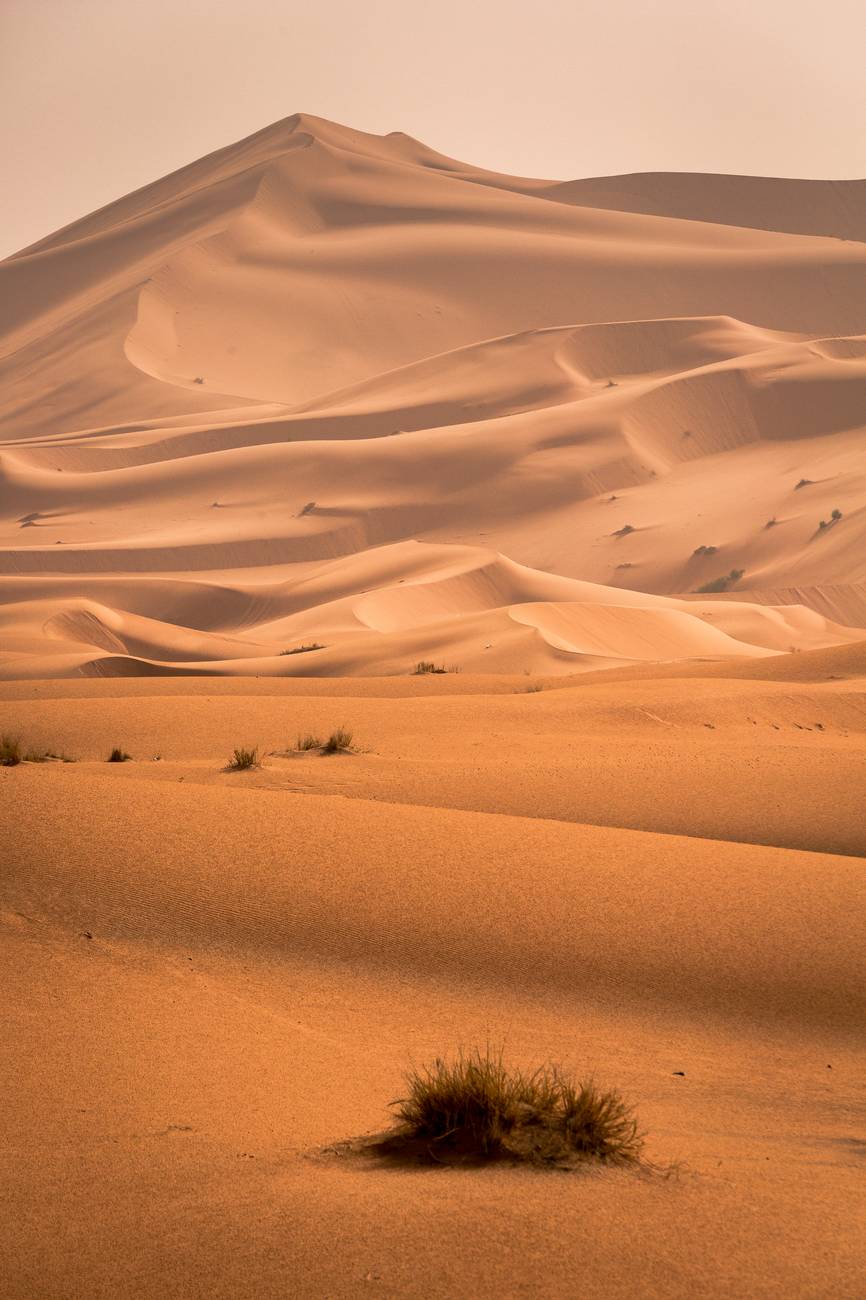
For our research, we have a few field campaigns planned, the first are repeat Multi-Beam Echosounder (MBES) surveys in the Mississippi River, LA and the second are UAV flights over the Algodones Dune Field, CA to accompany existing LiDAR data. The MBES surveys will give us the opportunity to gain higher temporal resolution data of the Mississippi River. These surveys will allow for detail in how dunes move through rivers, how different scales of dunes move (like how small dunes move over big dunes), and how much sediment these dunes are transporting. With that information, we can scale-up our understanding of the river dune operations to begin investigating how giant sand dunes in deserts move. You see, in deserts giant dunes move much slower and their movement is difficult to observe (it takes a few years to see them inch forward!), but the movement of the smaller dunes that climb over the big dunes is observable over seasons. In Algodones, we have a few repeat LiDAR surveys available over the past 5 years and we also plan to fly the UAV over a big dune and use Structure from Motion (SfM) to gain high spatial resolution imaging. So, if we can use our understanding of how small dunes move over big dunes in rivers, then we can compare how the small dunes are moving over the giant dunes in deserts and infer how the giant dunes in deserts are moving too!

So what will all this data look like? In rivers, as we send sound waves through the water via MBES, the sound wave hits the river bed and comes back to the receiver. The time it takes for the sound wave to travel tells us the distance it traveled (Time = Velocity x Distance). When we travel up and down the river sending these sound waves to the bed, we start to reveal the shape of the riverbed. I like to think of this as using a paintbrush, and with each new brush stroke, we receive new data. As we ‘paint the riverbed’, we build a fuller image of the three-dimensional features on the bed, like dunes! We will also be surveying with Acoustic Doppler Current Profiler to gain flow velocity and discharge measurements. Below is an example surveying with MBES and a 3D image of the Paraná River.

A visualization of MBES data acquisition courtesy of isurvey-group.com and a three-dimensional map of MBES gridded data from the Parana River (Parsons, 2005).
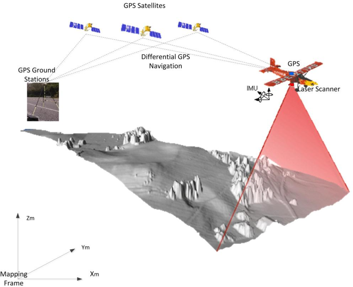
In deserts, we will use existing LiDAR (laser imaging, detection, and ranging) data, which is a high-spatial resolution topographic dataset. LiDAR is a method of sending laser light to the earth surface and measuring the distance by the reflection of those light waves. This LiDAR data, in particular, was gathered on board an airplane using a technique called airborne laser scanning. This technique allowed for a much larger area to be scanned, as the Algodones Dunes are kilometer scale. See below an example of airborne LiDAR acquisition.
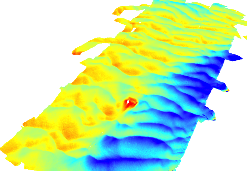
So you may want to know how we’re going to analyze that data. I’m excited to say we will be using a tool that I developed during my PhD, called BAMBI (the Bedform Analysis Method for Bathymetric Information). I developed BAMBI to work with high spatial bathymetric data, like MBES data grids, but it also works on any gridded data that represents bedforms. Of course, there are a few adjustments to be made, for example, BAMBI was made assuming unidirectional flows in fluvial environments and we know that aeolian and coastal environments can have multi-directional flow paths. Even so, BAMBI is a robust method that can measure big and small dunes and early testing shows it does pretty well at measuring sand dune morphology in deserts! Incorporating desert dune morphology into the BAMBI tool will allow us to create a universal way to measure, analyze and interpret bedform morphodynamics across environments. This information will be vital in bridging research and measurement techniques across aeolian, fluvial, and coastal environments and on other planets. Additionally, creating a universal analysis and measurement method will allow researchers to directly compare research areas, data, and observations and encourage transparency and reproducibility in our fields. Here’s an example of the output measurement locations from BAMBI when I ran it under the current version for White Sands Dune Field! Check it out! There will be so much more to share as this project continues!


Amazing work Julia. I’m impressed with BAMBI. You’re going to be an amazing scientist in the field of Geology and Geoscience.
LikeLike
Thanks, Grandma!
LikeLike